Drone Journalism
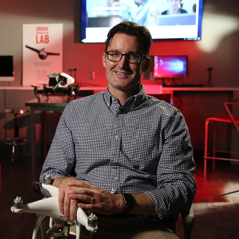
Matt Waite, a Pulitzer prize-winner, is teaching students how to open new frontiers for news, using drones to take news coverage where it couldn't go before.

Using drones, University of Nebraska–Lincoln scholars are doing innovative work that has the power to transform lives.
Drones are taking off – everywhere. Or they soon will be. Their utility is too varied and accessible for their potential to be grounded. Drones are changing the way people think about what's possible. Scholars at the University of Nebraska–Lincoln are leading innovative work to leverage the fascinating new power of drones.

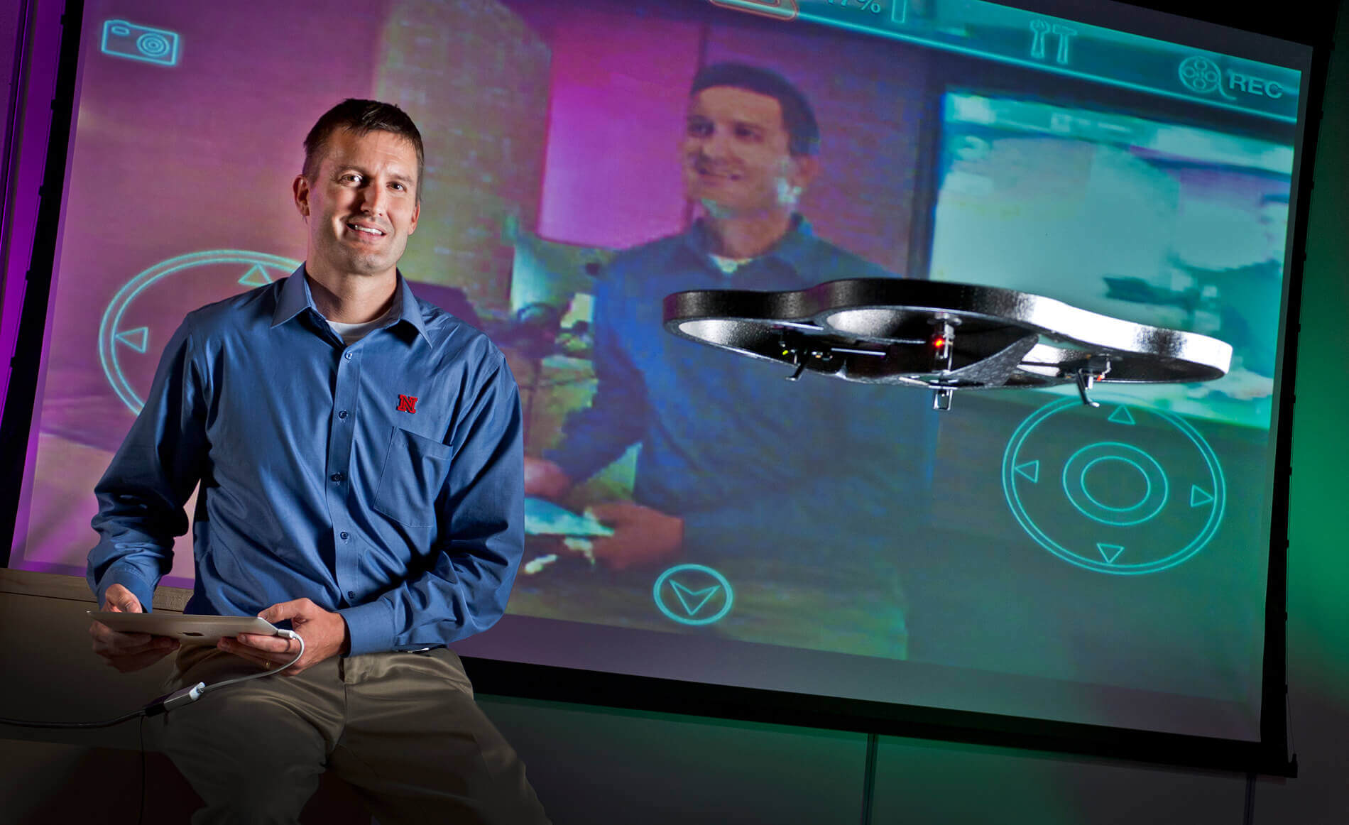
Matt Waite is driven to tell stories – in the most innovative ways possible.
From winning a Pulitzer Prize for his work developing PolitiFact to being the first journalist using satellite imagery analysis to establish and illustrate wetland decimation by developers, Waite has been at the forefront of using new technology in reporting.
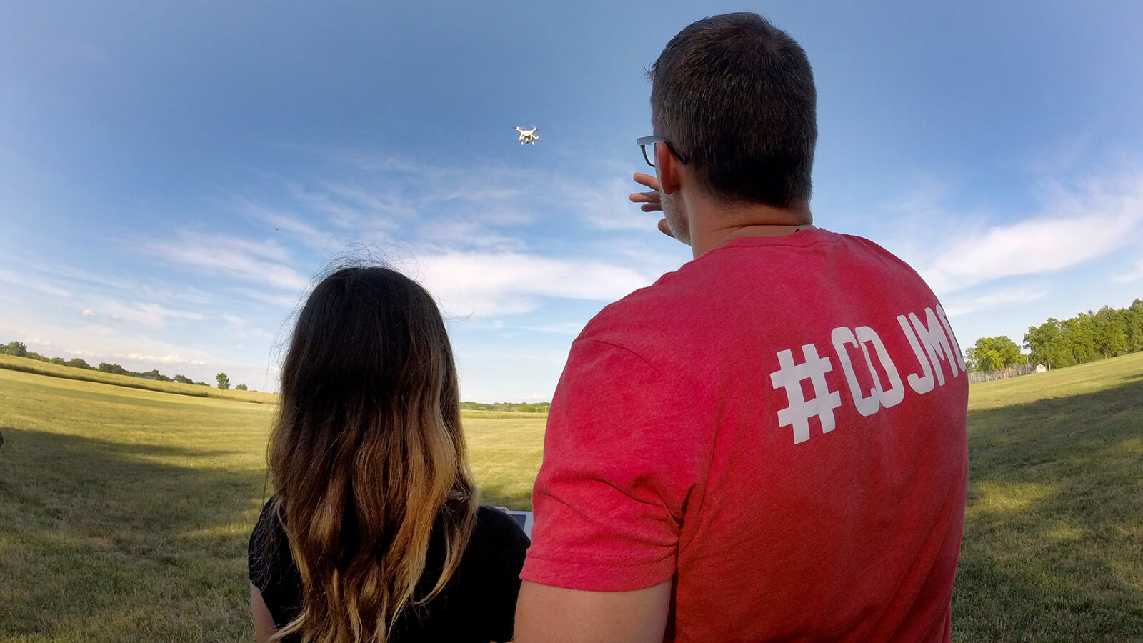
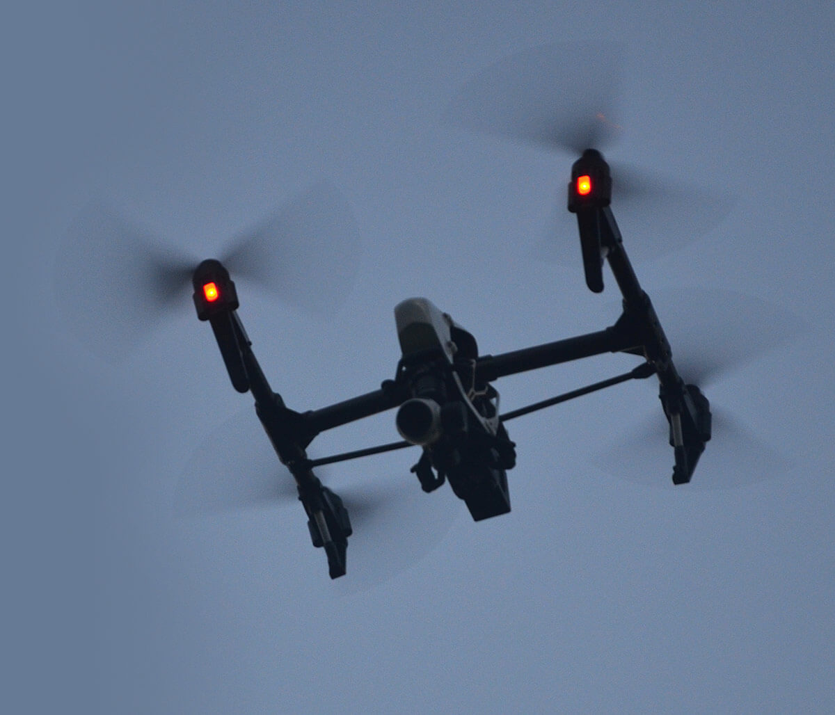
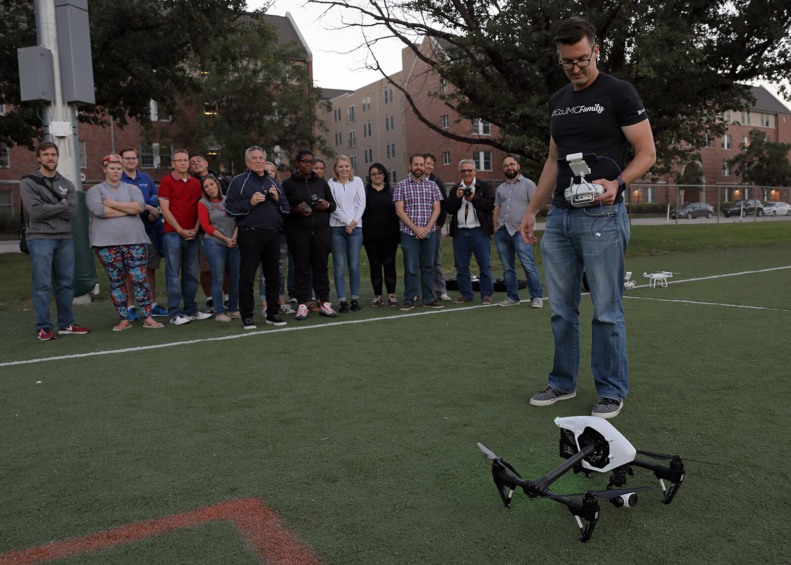
That drive to transform media pushed him to launch the Drone Journalism Lab at the University of Nebraska-Lincoln in 2011, putting Nebraska on the cutting edge of training current and future journalists.
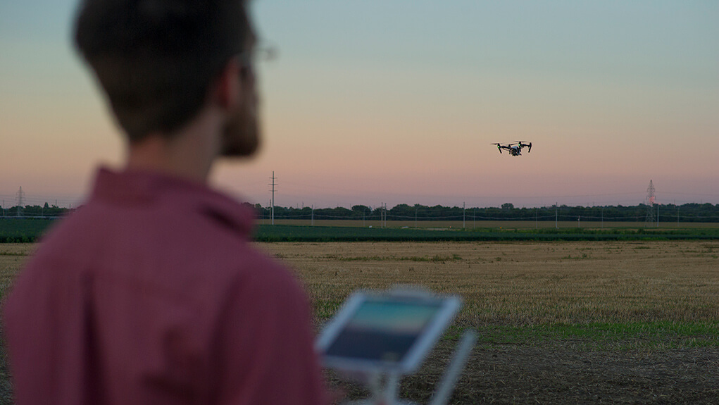
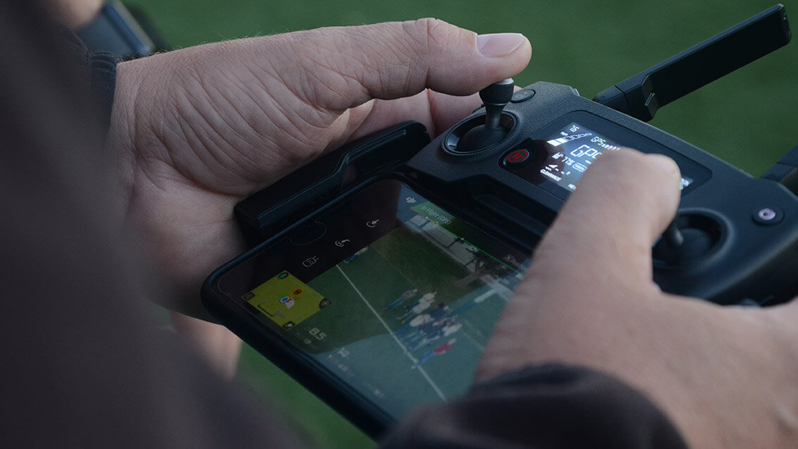
Drones for journalists are a tool. We use these tools to do stories, to inform the world.
In summer 2011, Waite was leaving full-time reporting behind and prepping for his first classes as an assistant professor of practice in the College of Journalism and Mass Communications. Based on the wetland reporting he’d done, Waite spent part of the summer speaking at geospatial geographic information systems meetings and conferences, including the Esri Users Conference, one of the largest international conferences for GIS professionals.
It was there he spotted something potentially game-changing for visually telling stories – a fixed-wing drone with a downward facing camera and a small computer inside. It could take photos while flying and piece them together into a composite image of a large parcel of land.
“I quite literally pulled my wallet out of my pocket, handed it to him and said, ‘I want that one.’” Waite said. “And he laughed and said, ‘Well, we're a Belgian company, and these are illegal in the United States. And they're $65,000 each.’ And I said, ‘I will take my wallet back, please.’”
Nothing could ever tell a story in scope and scale the way that could.
But Waite couldn’t let it go. He realized the possibilities with drones were endless, and no one was talking about it yet.
“I just couldn't stop thinking about every hurricane that I had covered while I was a reporter in Florida or every tornado that I covered when I was a reporter in Arkansas,” he said. “With every large-scale disaster I ever covered, how great would it have been to be able to do high resolution mapping, on the spot, in a matter of minutes?
“Nothing could ever tell a story in scope and scale the way that could.”
Waite took the idea back to the dean of the college at the time, Gary Kebbel. Kebbel immediately gave the go-ahead. Within days, Waite had a website up and had tweeted about his new idea, which caught the attention of the John S. and James L. Knight Foundation.
“One conversation, one website, one day, and we had media coverage, and we had funding.” he said. “Nobody knew what this was going to look like. The drone industry didn’t really exist yet.”
Then the turbulence started.
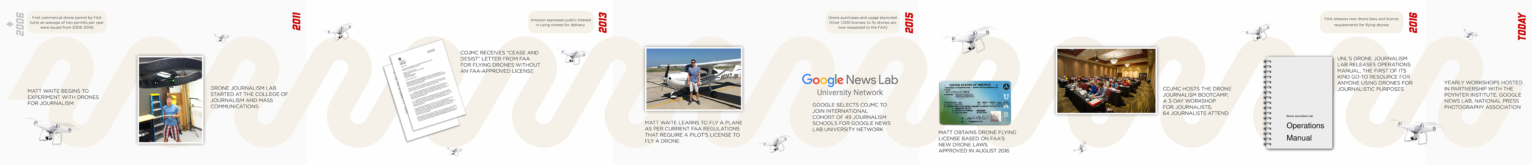
Very few rules and regulations regarding drones had been established by the Federal Aviation Administration by 2011. Waite thought he was following the patchwork of policies as best he could – until he got a cease and desist letter.
“Forty different news organizations picked up that first story we did on the Nebraska drought, with our video from the Platte River,” Waite said. “Eight months later, we got a letter from the Kansas City Office of the Federal Aviation Administration.
“If you ever have the opportunity to receive a cease and desist order from a federal regulatory agency, you really should. It's an exhilarating experience. You will never feel more alive. You'll also wonder about federal prison for a few moments.”
Waite was floored, but he picked up the phone. After a conversation with the FAA, he had a new outline of regulations and a “little bit” of paperwork.
“A little bit of paperwork to the FAA takes about a year to complete,” Waite said. “We actually had to get a letter from the Nebraska Attorney General that said, ‘Yes, indeed, the University of Nebraska is a public entity and a government institution.’”
Forty different news organizations picked up that first story we did on the Nebraska drought, with our video from the Platte River.
The paperwork was submitted in 2014, but the FAA rejected the application. The administration had put new regulations in place, requiring commercial drone operators, which is what the FAA was now classifying the university’s work, to get a pilot’s license.
Again, Waite complied, spending the summer of 2014 getting his pilot’s license, but the FAA rejected his application because, again, they’d come up with another new set of rules.
This time, though, the hiccup put Waite in the right place at the right time. Through his conversations with the FAA, he realized there would need to be a training manual and other resources at the ready for when the FAA formally announced the new regulations, which included a new knowledge test.
“I quite literally pulled my wallet out of my pocket, handed it to him and said, ‘I want that one.’” Waite said.
“And he laughed and said, ‘Well, we're a Belgian company, and these are illegal in the United States. And they're $65,000 each.’ And I said, ‘I will take my wallet back, please.’”
Waite published the pre-eminent drone journalism operations manual in the Creative Commons in 2016. The new FAA regulations went into effect Aug. 29, 2016.
Waite was also able to design a drone journalism boot camp for students and professionals, which has been repeated across the country for professionals and as pop-up classes for students.
There are now hundreds of professional journalists in the field using what they learned from Waite’s trainings. Former students, like Ben Kreimer, have traveled the world using these tools to tell stories on an epic scale.
But Waite also sees the caveats of using drones, and their ability to cause harm. With every talk and training he does, ethics and responsibility take the lead.
There are now hundreds of professional journalists in the field using what they learned from Waite’s trainings.
“Journalists have a tremendous amount of responsibility under the First Amendment of the Constitution,” he said. “We have power and the power that we have is the power of attention.
“We bring the attention. We have very little power over what happens next, but we can command an audience to take a look at something. We need to be thoughtful about what we are bringing attention to and how we were doing that.
“Just because you can, doesn’t mean you should. How you use a drone and what you choose to highlight with it says a lot about you and your ethics and how thoughtful you've been about what you're doing." 

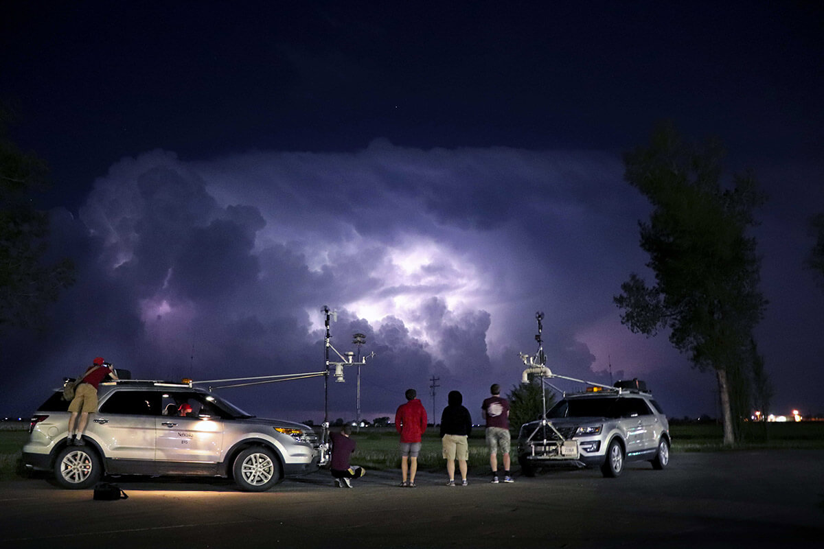
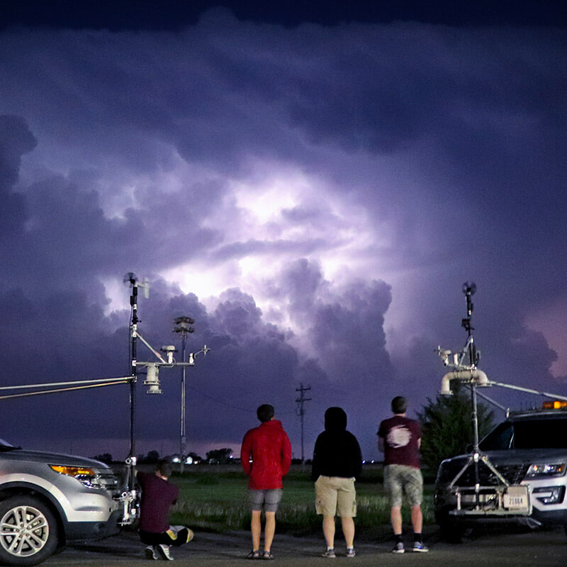
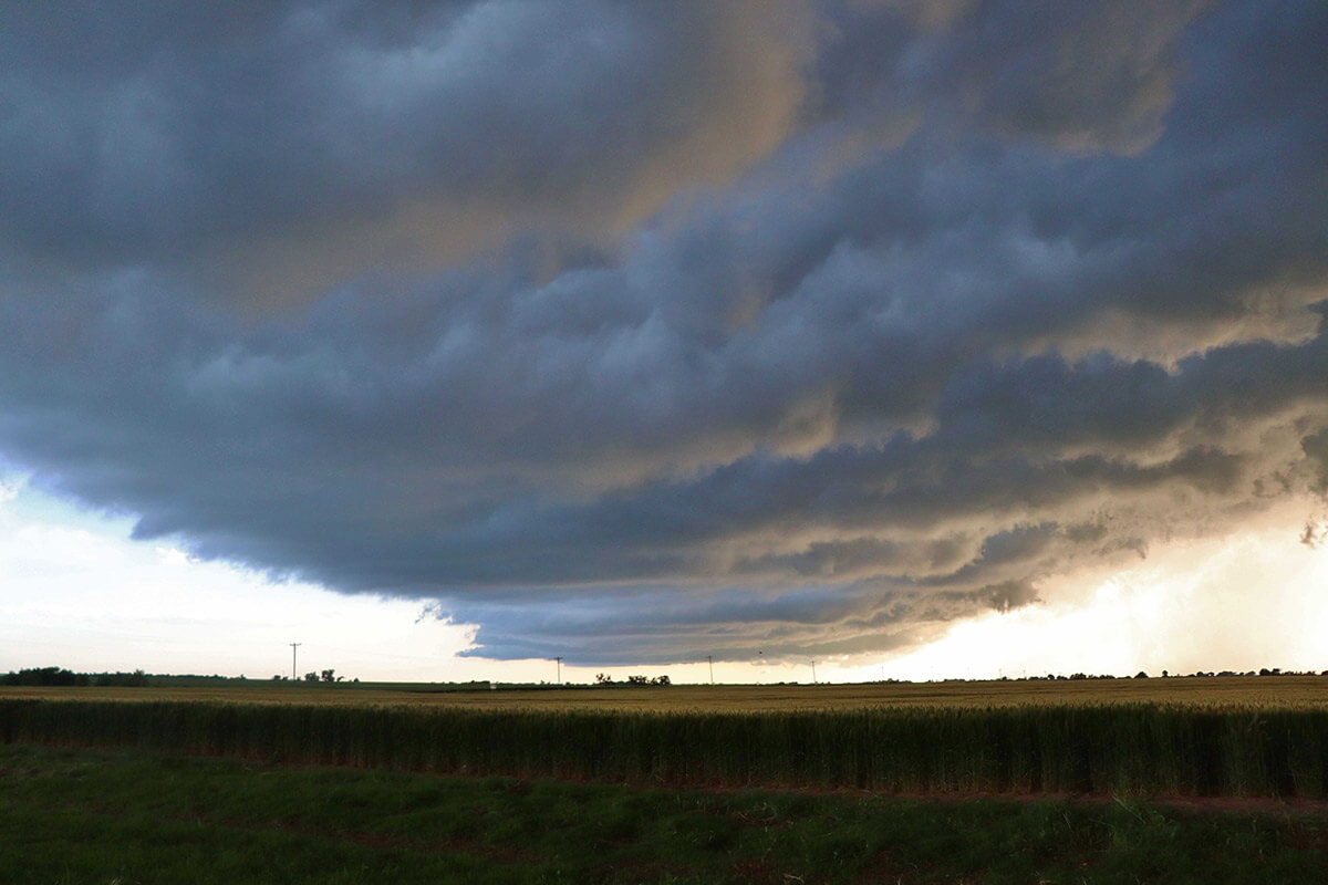
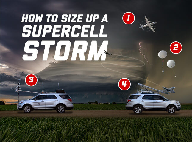
A Nebraska-led research swarm is buzzing the hearts of developing thunderstorms, collecting high-resolution data that ultimately may improve forecasting of tornadoes and severe weather.
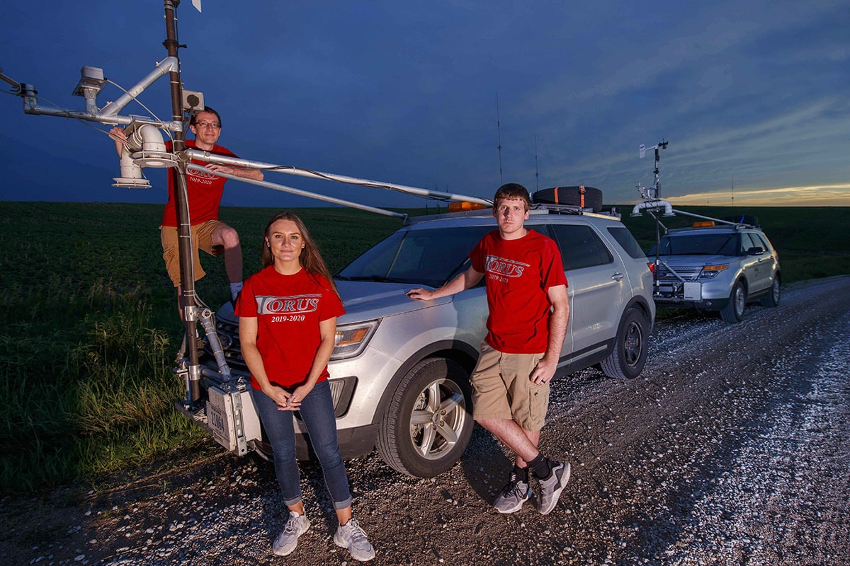
The federally funded $2.5 million TORUS (Targeted Observation by Radars and UAS of Supercells) project is focused on studying storm structures hypothesized to portend the formation of tornadoes. The team uses a phalanx of cutting-edge technology — from a quartet of drones to ground-based radars — to study the storms.
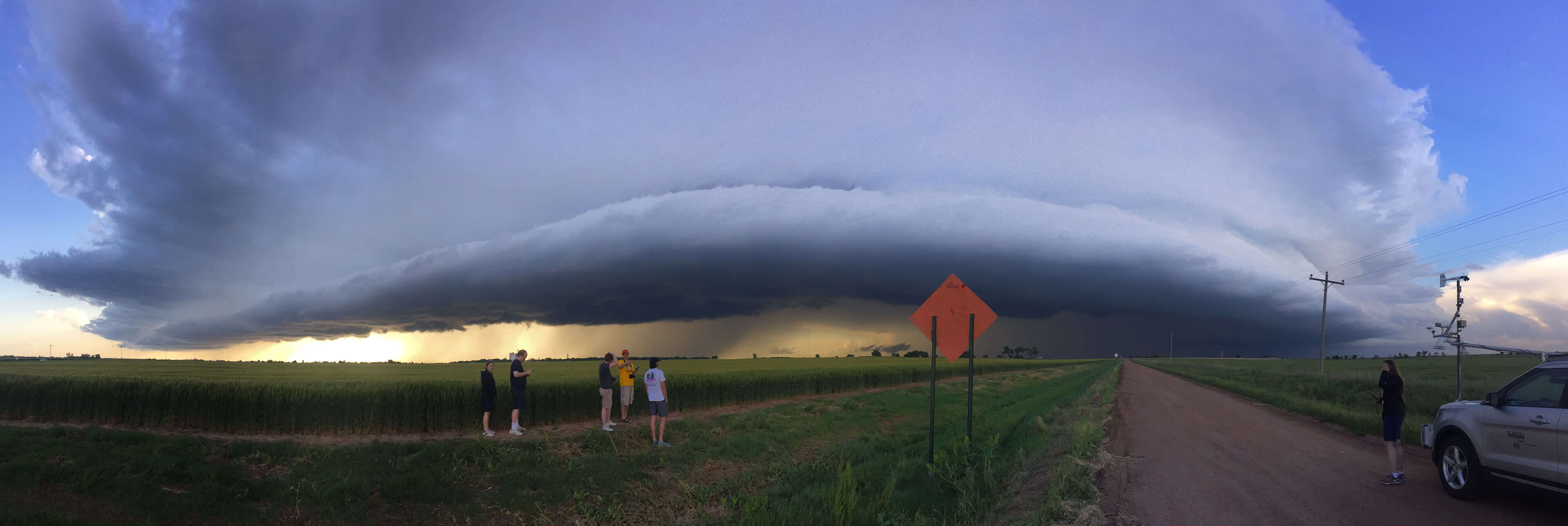
In June, the team completed its first of two fully-funded seasons — a wildly successful venture that resulted in 17 storm intercepts with seven tornadic supercells targeted and 51 drone missions flown across 14 deployment days.
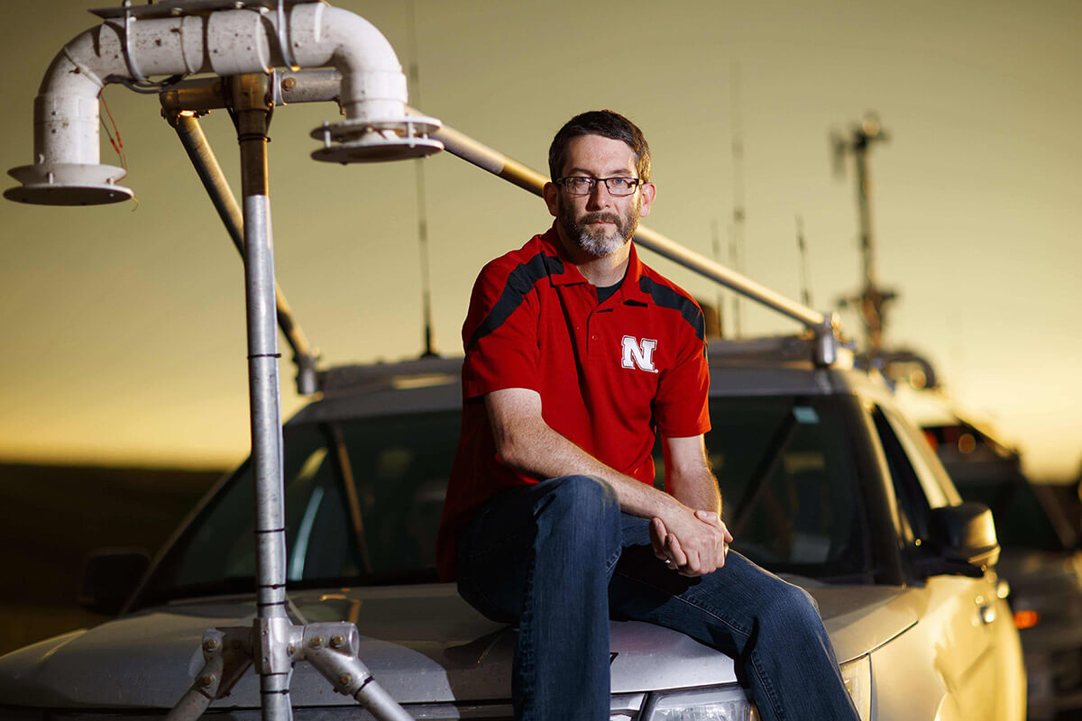
“We had a very active season and we were lucky enough to deploy our assets in the right place at the right time,” said Adam Houston, lead investigator for TORUS and professor of atmospheric science at the University of Nebraska–Lincoln. “We’ve only just started looking at the data, but we have a pretty good sense that our first season was very successful.”
TORUS is the most ambitious drone-based investigation of severe storms and tornadoes ever conducted.
Recording data from multiple atmospheric levels simultaneously, TORUS is the most ambitious drone-based investigation of severe storms and tornadoes ever conducted.
In terms of geographical area alone the study is the largest of its kind, covering 367,000 square miles across the Central Plains, from North Dakota to Texas, Iowa, Wyoming and Colorado.
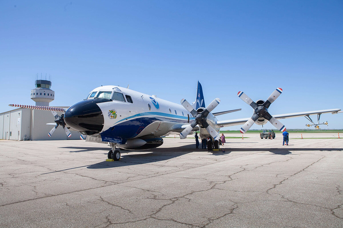
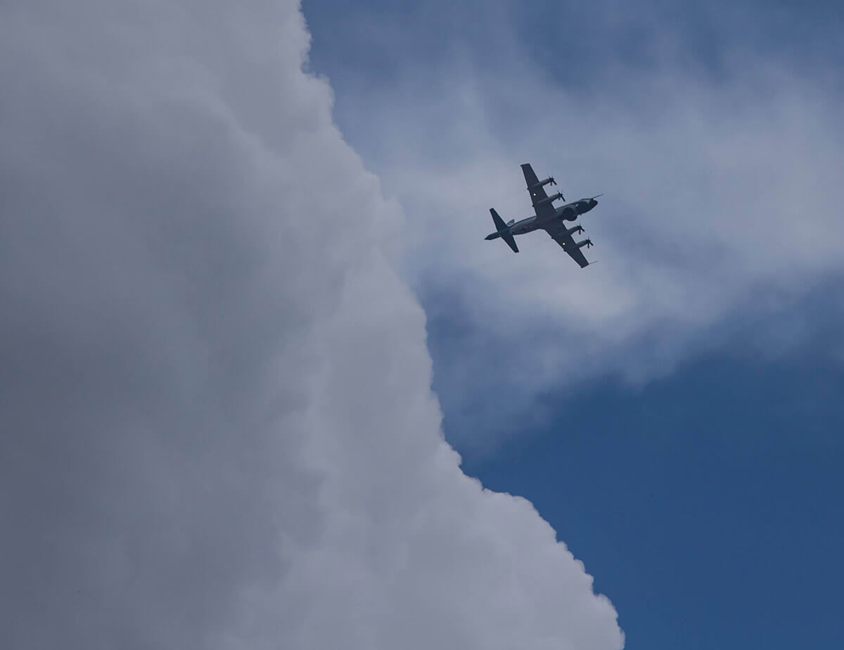
TORUS involves nearly 60 researchers from four universities — University of Nebraska–Lincoln, University of Colorado at Boulder, Texas Tech University and University of Oklahoma — studying storms from multiple atmospheric levels. In the air, the researchers probe storms with custom-built RAAVEN drones, a P-3 “hurricane hunter” aircraft from the National Oceanic and Atmospheric Administration; and three balloon-borne sensor launchers. On the ground, intercepts feature more than 20 vehicles, including eight mesonet trucks equipped with multiple meteorological instruments; three mobile radar systems and a mobile LIDAR system.
This configuration allows us to fly in more parts of the storm at the same time, collect more data, develop a more complete picture of storm formation and answer a more extensive set of questions.
“We’re flying more aircraft at the same time,” said Houston. “In the past, we’ve only flown a single drone. We flew three this year and will add a fourth next year.
“This configuration allows us to fly in more parts of the storm at the same time, collect more data, develop a more complete picture of storm formation and answer a more extensive set of questions.”
The research goal is use data collected to improve the conceptual model of supercell thunderstorms, the parent storms of the most destructive tornadoes, by exposing how small-scale structures within these storms might lead to tornado formation. These structures are hypothesized to be nearly invisible to all but the most precise research-grade instruments. By revealing the hidden composition of severe storms and associating it to known characteristics of the regularly-observed larger scale environment, the TORUS project could improve supercell and tornado forecasts.
"There are fundamental problems with tornado warnings," Houston said. "The false alarm rate is high — 75 percent of the time we don't get a tornado. Yet if you reduce the false alarm rate, you also reduce the rate of detection. We need to improve that gap to save lives. We can do that if we can improve our understanding of small-scale structures and small-scale processes that lead up to tornado formation.
"We want to know how the storm influences the environment, and vice versa, in the seconds, minutes and hours leading up to the storm and afterwards."
To collect data on developing supercells, TORUS researchers divide into four distinct missions — left flank, right flank, near inflow and far inflow.
The near-inflow mission includes the majority of the team and is tasked with measuring the edges of the approaching storm with ground-based radar, a RAAVEN drone, mobile mesonets and the P3 aircraft.
The far-inflow mission is stationed miles ahead of the approaching storm, launching balloon-borne sensors that collect data from the ground to upper levels of the atmosphere.
The remaining two missions each feature RAAVEN drones, scout vehicles, mobile mesonets, mission leads and tracker vehicles. Both are tasked with probing the storm more directly — the right-flank collects data on the southernmost part of the developing storm; the left-flank probes directly into its path.
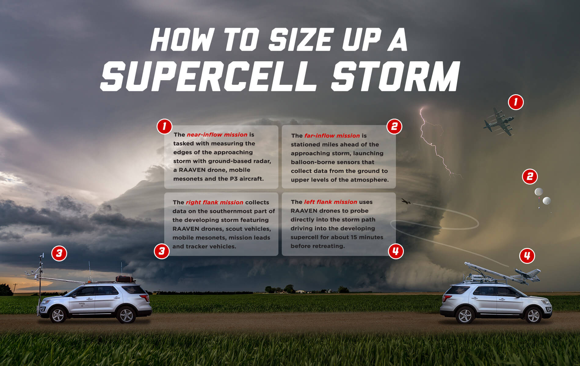
1 The near-inflow mission is tasked with measuring the edges of the approaching storm with ground-based radar, a RAAVEN drone, mobile mesonets and the P3 aircraft.
2 The far-inflow mission is stationed miles ahead of the approaching storm, launching balloon-borne sensors that collect data from the ground to upper levels of the atmosphere.
3 The right flank mission collects data on the southernmost part of the developing storm featuring RAAVEN drones, scout vehicles, mobile mesonets, mission leads and tracker vehicles.
4 The left flank mission uses RAAVEN drones to probe directly into the storm path driving into the developing supercell for about 15 minutes before retreating.
If the left and right flanks are successfully positioned, the most likely area a tornado will form is between their sensors.
“We try not to get too close, ideally we’re two to five miles away at all times,” said Houston, who led the left-flank mission. “It wasn’t our intent, but sometimes we were closer.”
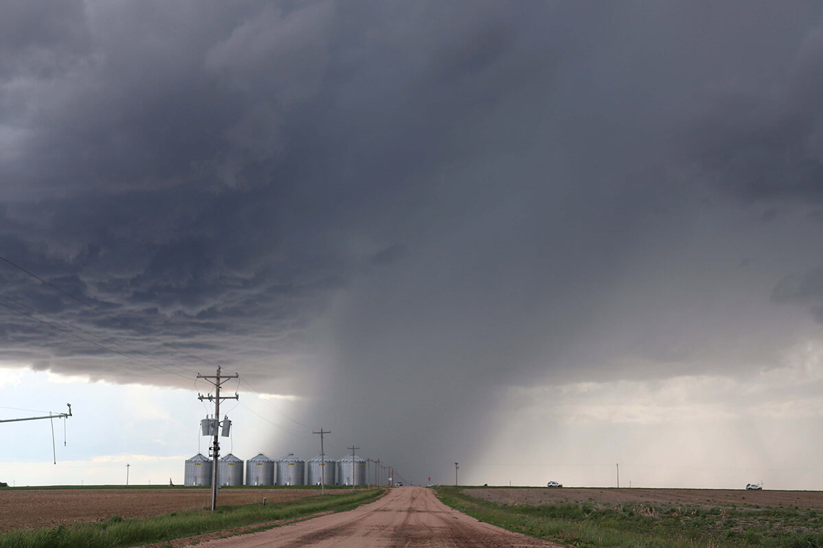
Due to battery limitations with the drones, each of the flanks probe the storm twice, operating for about an hour. A textbook intercept allows the team to approach from distance, driving into the developing supercell for about 15 minutes before retreating. The team then reverses course and — if possible — conducts a second approach and retreat.
It was a nearly perfect intercept in terms of what we’re searching for — observations of a developing storm and data immediately prior to a tornado.
After covering more than 9,000 miles across five states this summer, the TORUS team has transitioned to reviewing its first year of data and planning for the 2020 season.
The approach worked perfectly in the TORUS team’s first intercept of the season. That storm, which formed near McCook, Nebraska, on May 17, was long-lived and dropped multiple tornadoes.
“For that storm, we were able to coordinate deployments and get some quality data,” Houston said. “We completed our first approach and, as we came back out, a tornado formed.
“It was a nearly perfect intercept in terms of what we’re searching for — observations of a developing storm and data immediately prior to a tornado.”
“We should have some preliminary results before the end of the year, we’ll most likely wait until the conclusion of next season to publish papers,” Houston said. “But, if we do see something really interesting in the data from this first season, we might do an individual case study that’ll help with additional research funding.”
Overall, the drones have proven more durable than expected and the team will be taking a fourth one into the field.
“The drones are actually able to fly in areas that are more hazardous than where the P3 can go,” Houston said. “They’re incredibly durable machines. They can fly in heavy rain and — while we try to keep them out of trouble — we learned they can take hail up to a quarter in size.”

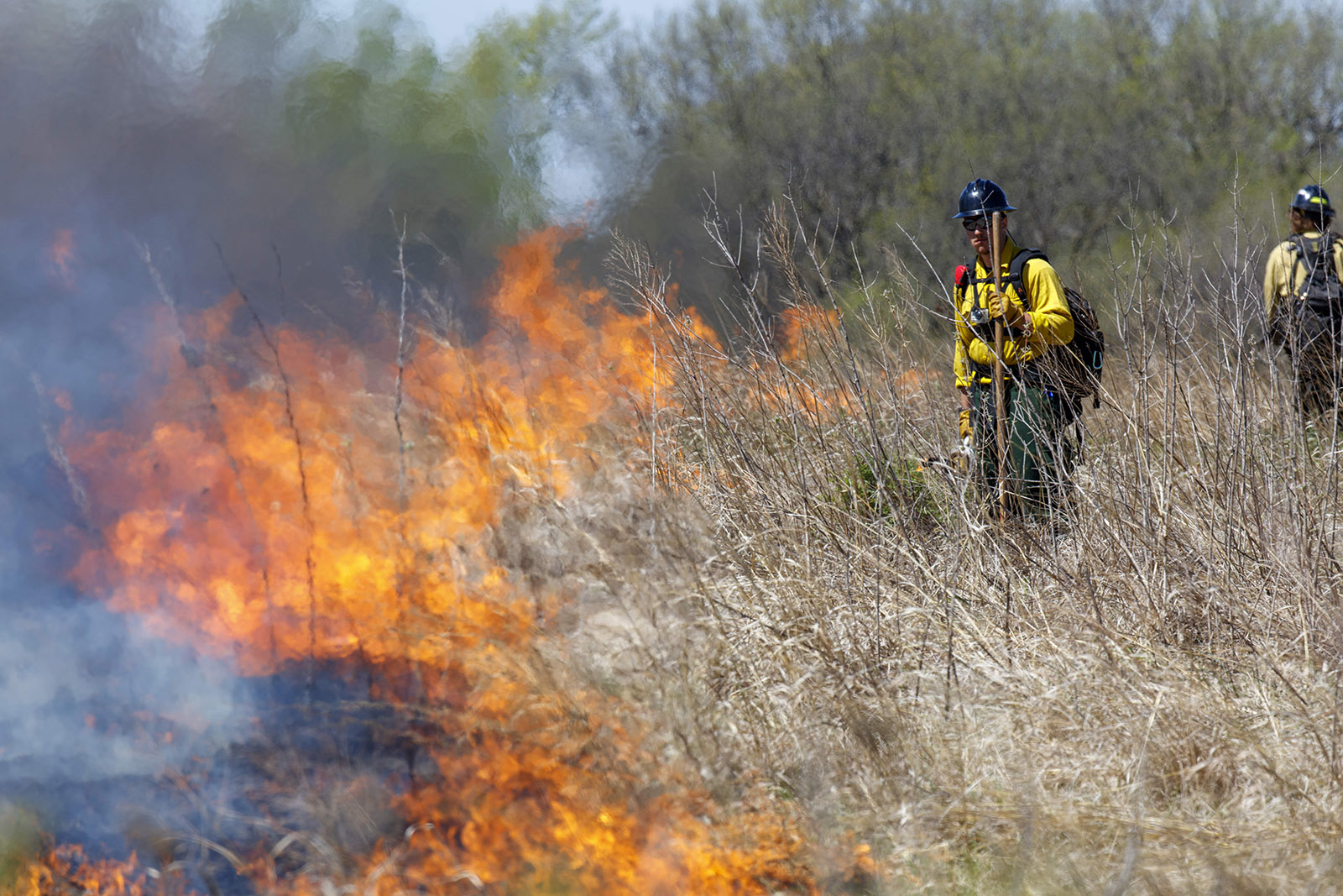
As fire seasons stretch longer and blazes burn hotter, a team from the University of Nebraska–Lincoln is innovating with drones to fight fire with fire and keep people out of harm’s way.
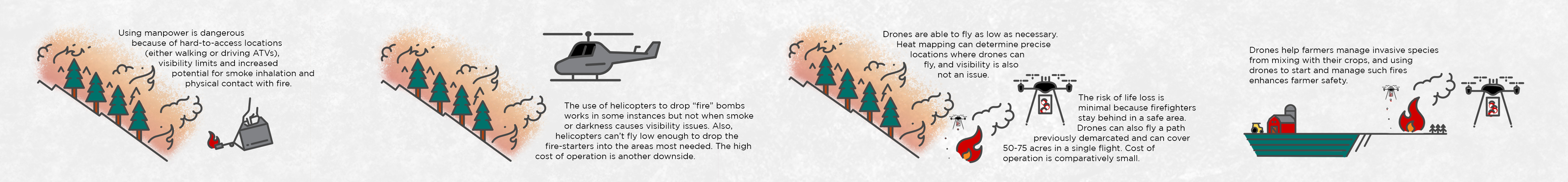
Intentionally sparking small fires that burn vegetation and starve incoming wildfires of potential fuel has primarily been carried out via a helicopter, which is expensive, or by hand lighting either on foot or four-wheeler, which is dangerous.
Cue the drone.
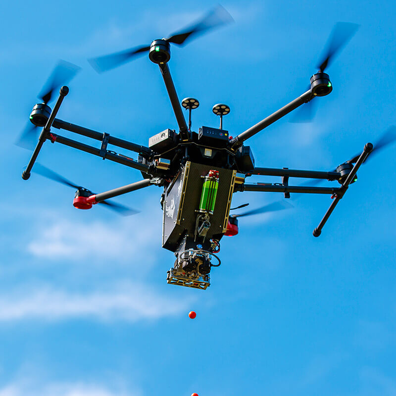
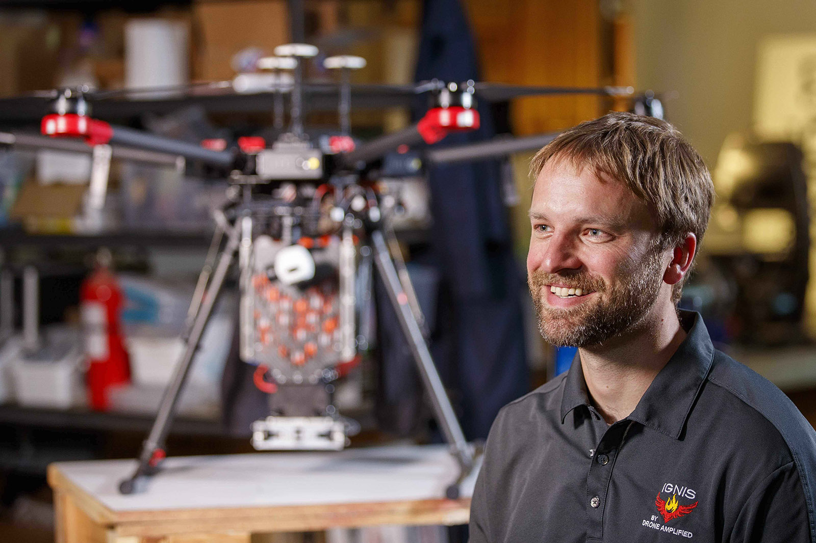
But not just any drone. A team led by Carrick Detweiler, associate professor of computer science and engineering, spent five years developing, testing and modifying dozens of drone designs specifically for fire management.
A team from the University of Nebraska–Lincoln is innovating with drones to fight fire with fire and keep people out of harm’s way.
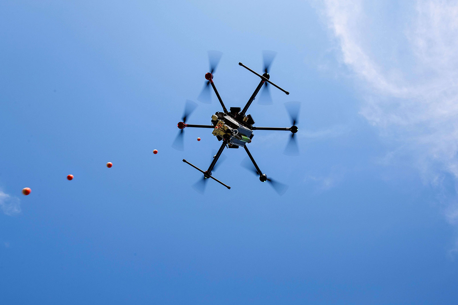
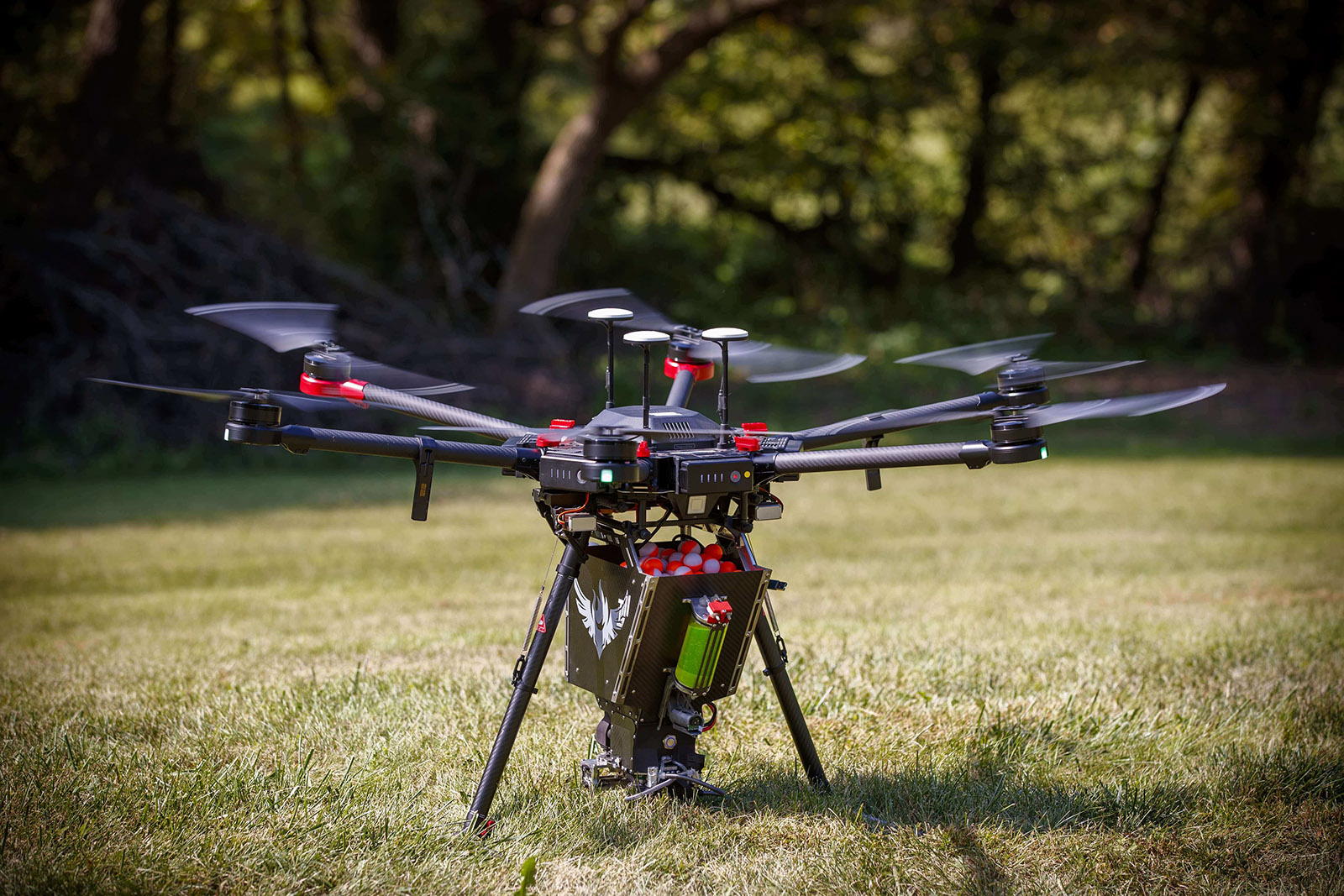
Detweiler and his colleagues have landed on drone-mounted, market-ready technology that carries chemical spheres the size of ping-pong balls. At the press of a button, the spheres drop and ignite to start small fires to burn vegetation that would otherwise be potential wildfire fuel.
“The first system we had could drop four or five of these ignition spheres,” Detweiler said. “Now we're up to a system that can carry and drop four or 500.”
To make the drone system easier to use, the team has developed a custom software application to automate every attribute: mission duration, altitude, where to drop the spheres, how many to drop and the time between each. The app also allows users to create virtual boundaries that keep the drone within select areas.
The system includes a thermal camera, which aids visibility and introduces a new option for firefighting crews: nighttime operations. These operations are generally considered off-limits due to low visibility.
With this drone, there’s no possible risk to human life.
“It’s normally too dangerous to fly at night over a fire, but with this drone, there’s no possible risk to human life,” Detweiler said. “It provides situational awareness at night to safely fly and ignite burns, which really gives ground crews an advantage during the daytime.”
Users from the federal government, private companies and nonprofit organizations have provided input on the drone system and its software. The team then uses this feedback to develop new features, such as offline elevation maps, which help users fly over mountainous terrain.
The team has also worked with NUtech Ventures, the university’s commercialization affiliate, to patent and license the technology for their startup company, Drone Amplified.
“Our product fills a niche in the market,” said Jim Higgins, chief engineer and Nebraska alumnus. “It allows crews to ignite large, complex burns without the danger factor.”
The team has seen users discover the benefits of its drone technology firsthand. At the 2018 Klondike Fire in Oregon, firefighters were initially hesitant to use the drone, Higgins said — but by the end of a monthlong deployment, they were regularly requesting to fly it as part of their daily operations.
Higgins has conducted training for employees from multiple federal agencies who have since used the drone system to fight fires in Arizona, Alaska and other sites around the country. The team also has a strong partnership with the U.S. Department of the Interior; in 2017, the agency named their technology one of the ‘Top 12 Made in America’ innovations.
The team is now focused on scaling its business to reach more customers — especially due to recent fatalities involving firefighting helicopters, which is driving an urgency to find safer replacements, Higgins said.
I think we’re right at the leading edge of this wave of using unmanned systems in firefighting. We want to save the lives of people doing very dangerous jobs.
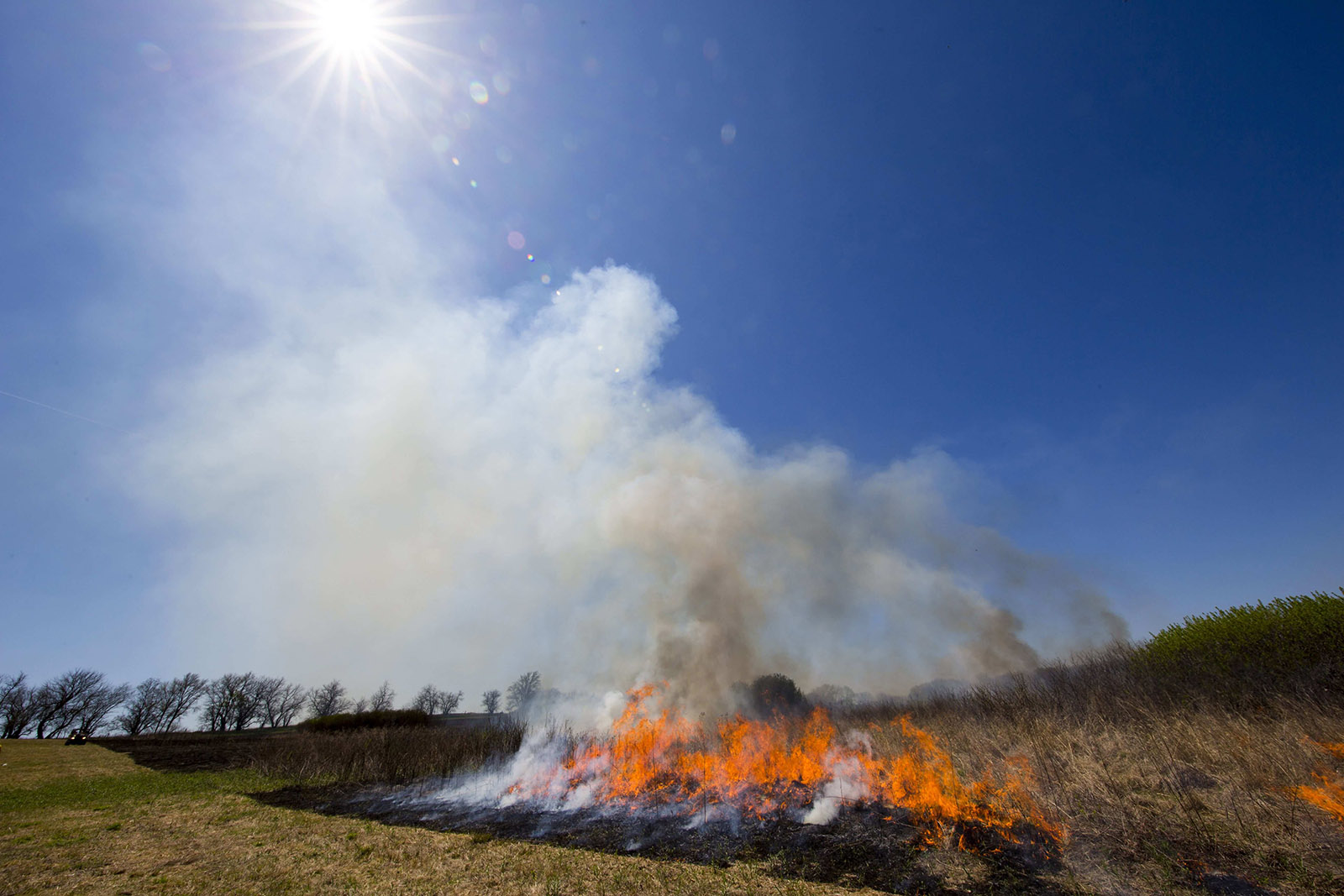
Farmers, ranchers and others working in agriculture have recognized the value of managed fires in maintaining grasslands and other natural landscapes. Managed fire has been demonstrated to be one of the best methods of reducing invasive cedars and restoring habitat. In Nebraska and areas across the country where prescribed burns are used widely for agricultural land management, fire ignition drones present a safer alternative to lighting fires by hand.
While Drone Amplified’s product represents a distinct way to manage fires, the team foresees drones becoming a standard tool, as normal as picking up a firehose or calling in a bulldozer. It’s a vision they’re working to fulfill.
“I think we’re right at the leading edge of this wave of using unmanned systems in firefighting,” Detweiler said. “We want to save the lives of people doing very dangerous jobs.